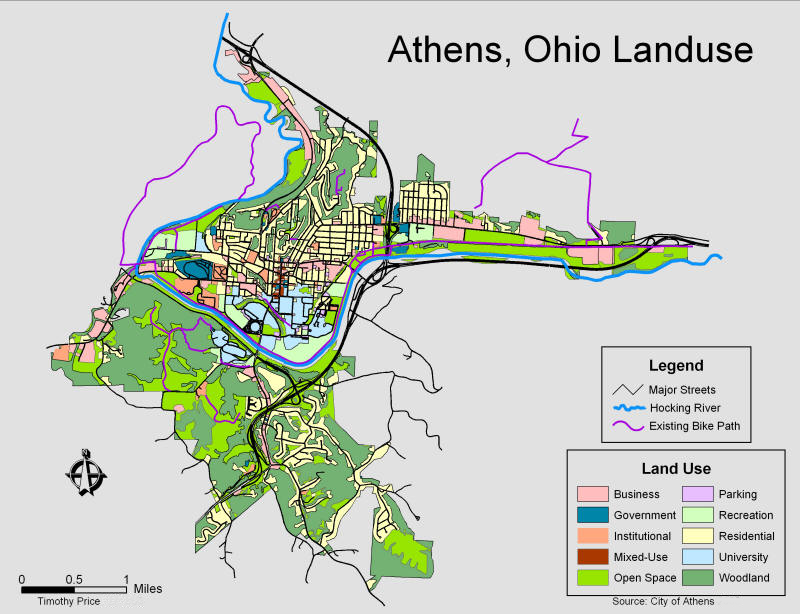
Land Use Planning
Summary: This map of Athens, Ohio, illustrates how TAP GIS Services can take a variety of data relating to commercial districts, subdivisions, signage, flood zones and so much more and transform it into accurate, comprehensive and easy-to-follow maps for use by professionals and the general public, whether online or in a printed format.

Geocoding Services
Summary: Created using insurance company client information, TAP GIS Services can help you visualize where the data is located. We provide high quality geocoding for place names, addresses and zip codes within the USA. With geocoded data, you can spatially display locations and recognize patterns within the information, allowing you to further analyze the information. Geocoding can help to establish marketing strategies that target specific clusters of customers to produce route maps and directions.
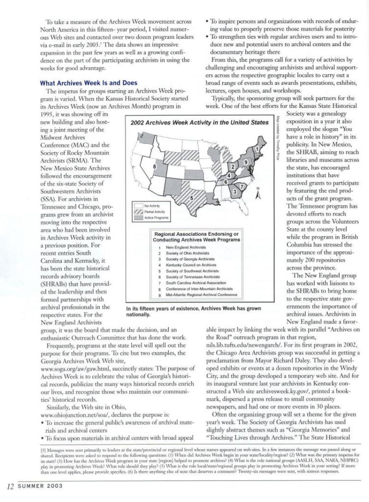
Journal Figures
Summary: TAP GIS Services created an inset for the Summer 2003 issue of “History News” for the American Association for State and Local History. History News is the official magazine of the AASLH, connecting people engaged in history work to new questions, ideas, perspectives, and each other.
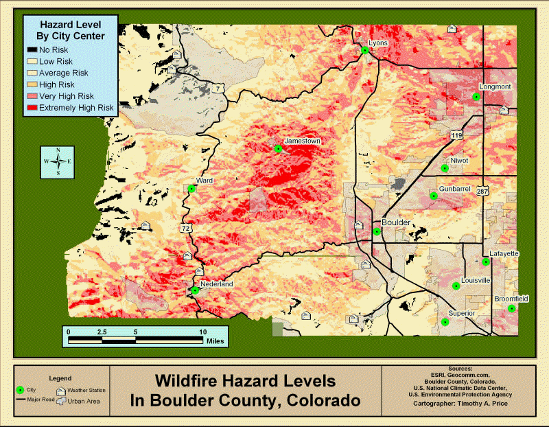
Data Analytics
Summary: Gathering data from multiple sources, TAP GIS Services can help your organization visualize the complex relationships that exist between people and places. The Boulder wildfire risk map is just one example of analysis that can be provided to your organization, offering you better insights and targeted solutions.
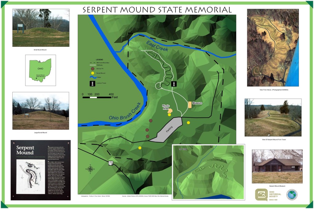
Serpent Mound State Memorial
Summary: TAP GIS Services conducted research in the spring of 2002 to assist with the mapping of the Great Serpent Mound, located in Adams County, Ohio. This historic site was mapped using Global Positioning Satellites data collected onsite, as well as DLGs, DRGs, DOQQs, and DEMs downloaded from on online repositories. The final product was a production quality map that showed not only the mound, but the elevation of the surrounding area as well. The project was submitted to the Ohio History Connection.
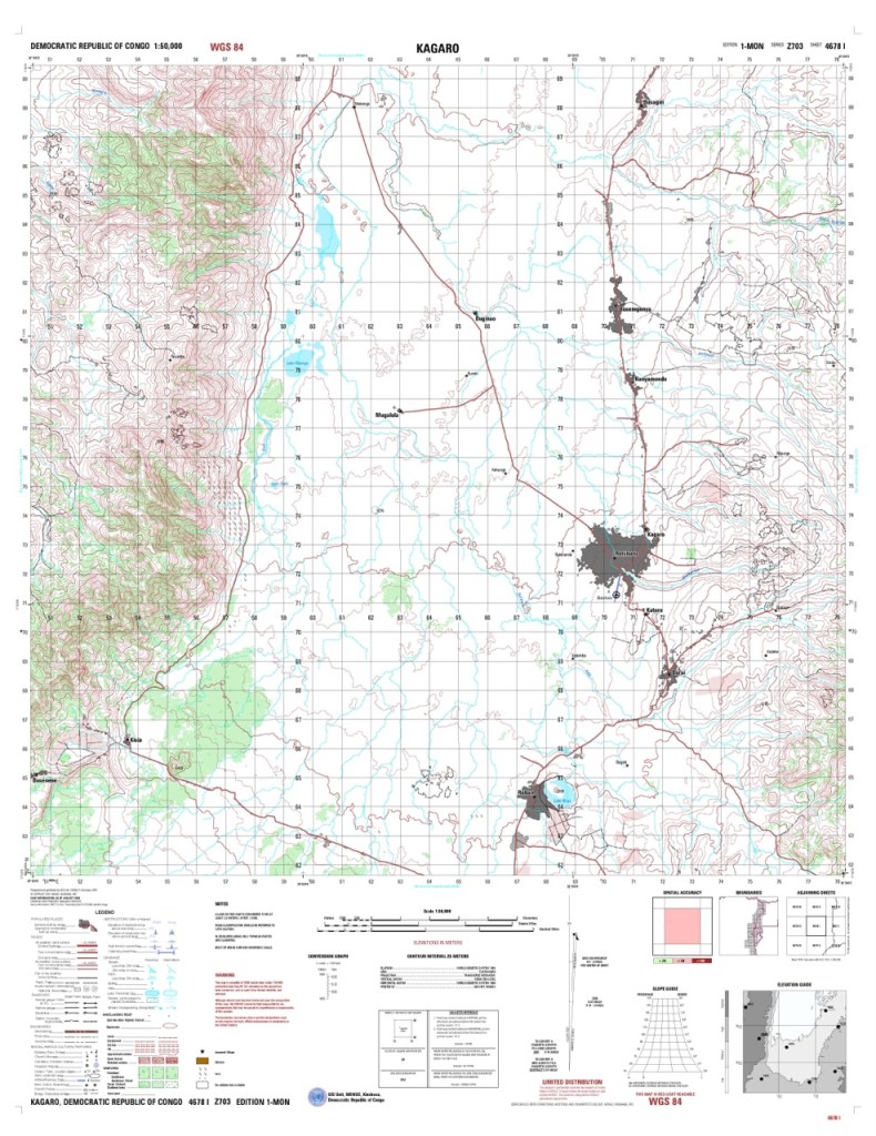
Kagaro, Democratic Republic of Congo
Summary: Working alongside United Nations Peace Keeping Forces in Kinshasa, DRC, this project involved implementing an enterprise GIS system to produce Topographic Line Maps (TLM50) of various regions using satellite imagery, field-based knowledge and military information. Projects such as this can help government agencies realize the benefits that GIS has to offer ,not only regional governments, but communities and businesses as well.


